Local-first · Free & open source

Birding analytics and tools for your eBird workflow

SnowRaven takes your eBird and Macaulay Library records and lets you explore them in new ways. Weather and tides for your checklists, deep per-species history, life-list analytics, media coverage, breeding records, and an interactive map. It uses your own exported data, on your own device, so you stay in control.

macOS · Windows · Raspberry Pi  ·  No account, no telemetry

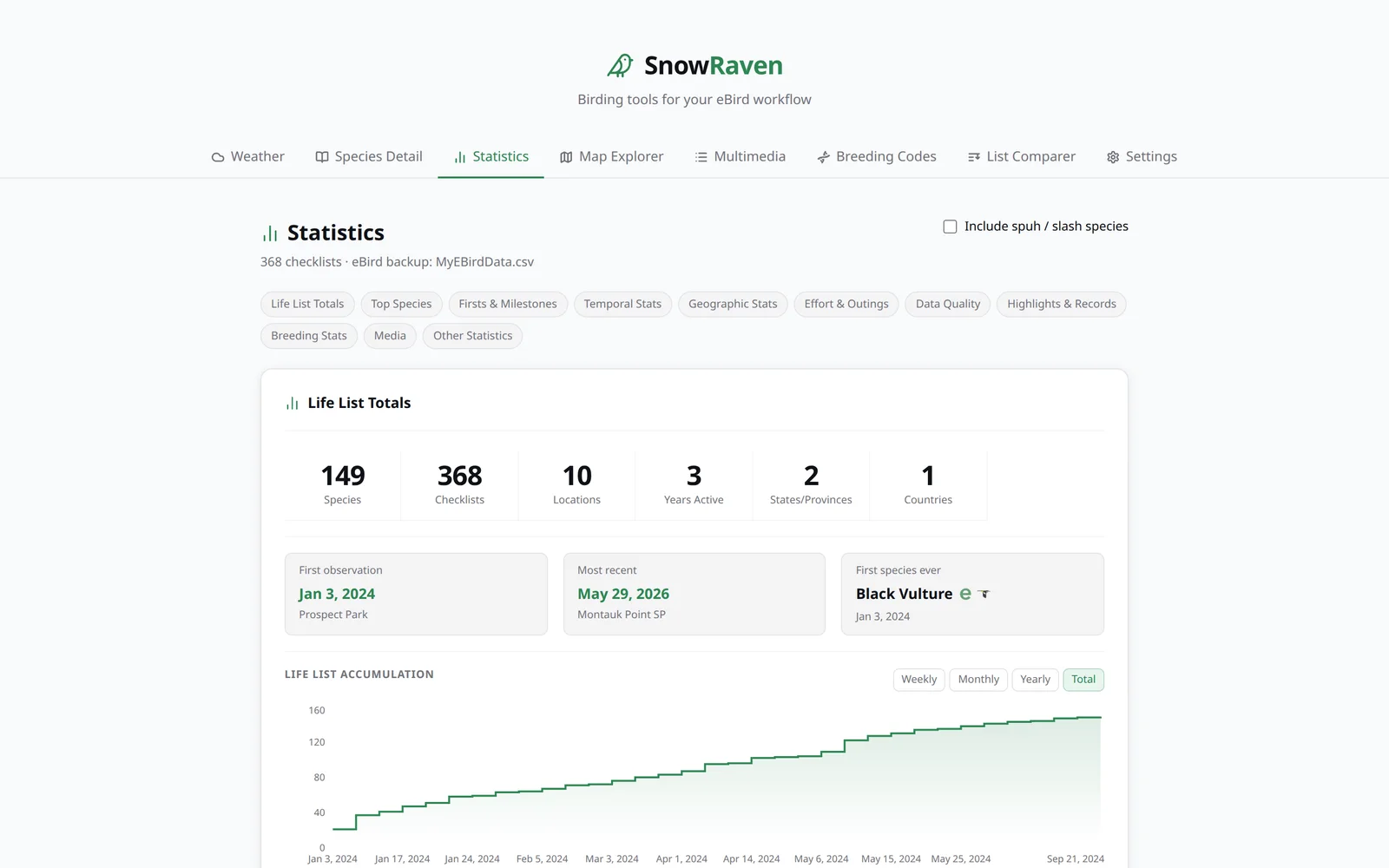
The SnowRaven Statistics tab showing life-list totals, a life-list growth chart, and section navigation.
Life list149 species
Tide3.1 ft rising

Privacy by design

Your data stays on your device

SnowRaven has no account, no analytics, no telemetry, and no server we operate. Your eBird backup, Macaulay Library export, settings, and API keys never leave your computer. When you ask for data, it talks directly to the services it draws from: eBird and OpenWeather with your own keys, plus keyless sources — OpenStreetMap, map tiles, NOAA tides, and the Cornell Lab sites that embedded Macaulay media and bird-link icons load from. There is no SnowRaven server in the middle. If you opt in to downloading an offline map region on the desktop app, that region's tiles are fetched from GitHub at download time (your IP and the region you chose are visible to GitHub then) and afterward stored on your device and served with no further network. It's off by default.

  • No accountsNothing to sign up for. Just open it and go.
  • No trackingZero analytics or telemetry, on every platform.
  • Keys & data stay localYour files and API keys live on your machine.
  • No developer serverWe run nothing. There is no SnowRaven cloud.

What's inside

Nine tools, one quiet workspace — and they work offline

Everything reads from the eBird and Macaulay Library exports you already have. No data entry, no busywork. Once your data has loaded, the tools keep working without a connection.

Weather & Tide Lookup

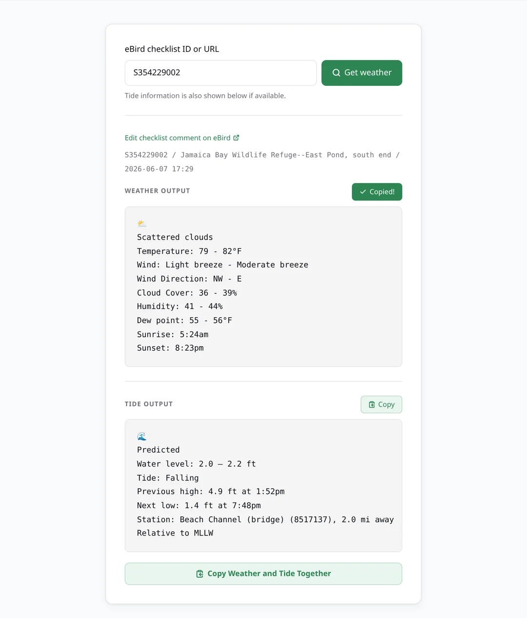
Paste an eBird checklist ID and get a clean, ready-to-paste weather summary: temperature, wind with its Beaufort description, humidity, dew point, sunrise and sunset, and the moon phase on night checklists. The same lookup fills in the historical tide from the nearest NOAA station, observed or predicted, with the surrounding highs and lows. Copy weather and tide together in one click. You can also skip the checklist entirely: Current shows the live weather and tide for where you are, and Predict forecasts both for a place and time you choose — about a week ahead for weather, and much further for the tide. A weather backlog at the bottom of the tab lists your recent checklists that still have no weather block — built from your own backup, newest first — so you can work down the ones you missed instead of looking them up one at a time, with a Copy weather & go action that copies a checklist's weather and opens its eBird comment page to paste.

The Weather tab showing a formatted weather summary and a tide block for a checklist at Jamaica Bay.

Species Detail

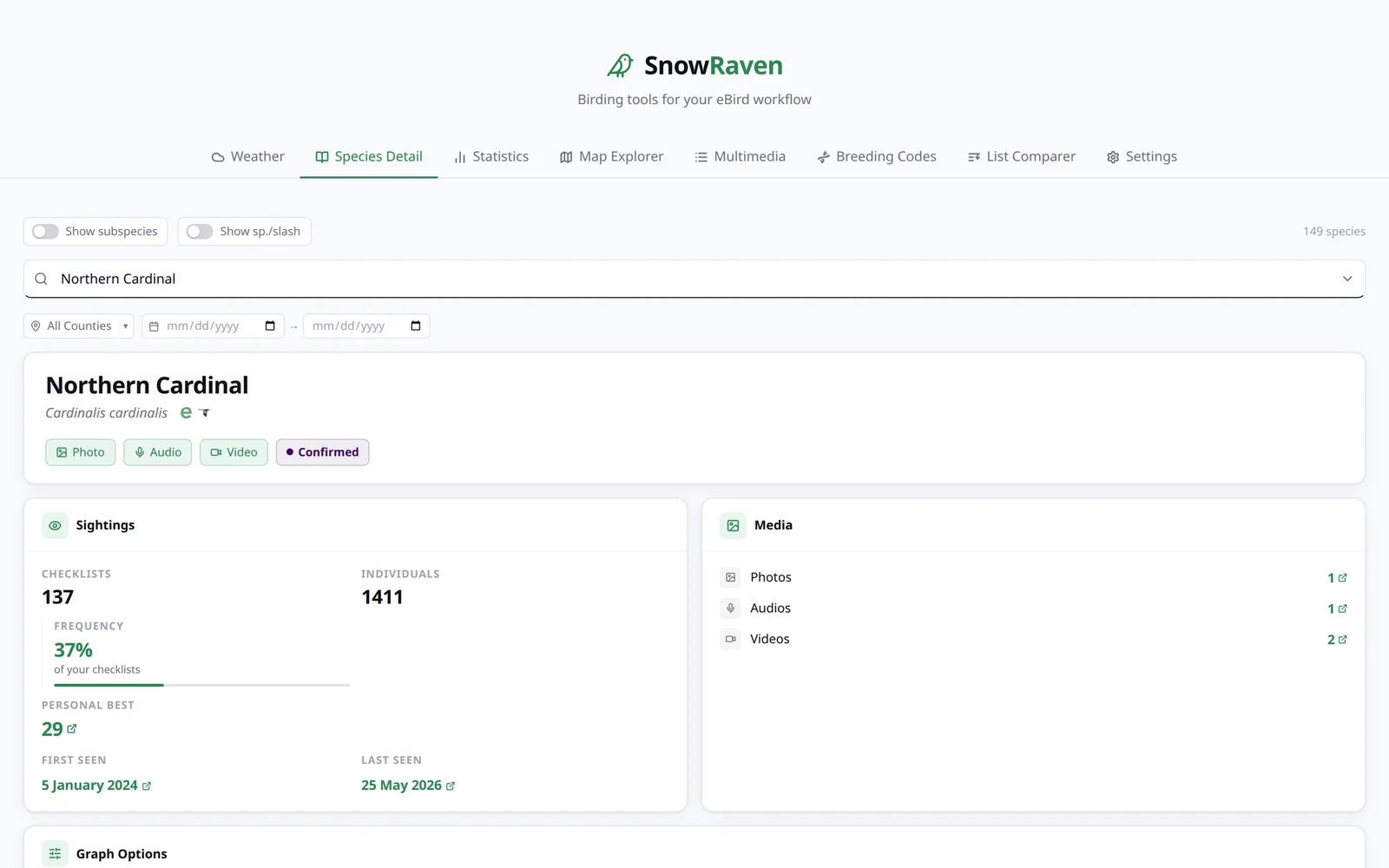
Your complete history with any species. Sighting stats, breeding codes, the species you most often see it with, field notes, top locations (public eBird hotspots link to their hotspot page, wherever a location name appears in the app), sightings-over-time graphs, a map of every observation, and your Macaulay Library media, all in one view.

The Species Detail tab for Northern Cardinal, showing sightings, media counts, and breeding category.

Statistics

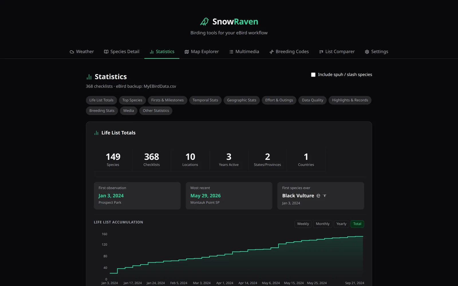
A full analytics dashboard built from your own data: life-list totals and growth, top species, firsts and milestones, temporal and geographic patterns, effort and methodology, data quality, breeding stats, and deep media statistics (documentation coverage, age/sex and behavior breakdowns), where the photo, audio, and behavior counts link straight to the matching media in your Macaulay Library. A Frivolous Lists section at the bottom adds a few playful, self-completing collections, just for fun.

Light or dark, your choice. Dark mode shown.

The Statistics tab in dark mode, showing life-list totals and a growth chart.

Calendar

A year of your birding as twelve month grids, like a wall calendar's twelve pages, each day carrying a number — the species you saw, the checklists you submitted, or the total count of individual birds you recorded, your choice. Each day is shaded by how busy it was, so the shape of your year reads at a glance: busy migration weeks, quiet mid-summer, a big count-day spike. Type-to-find a single species to see the seasonal shape of when you record it, page across every year your data covers or fold them all into one combined grid, switch between the big month grids and a whole-year overview of shaded, dated thumbnails, turn on a colorblind-friendly texture mode, and click any day for its checklists — each with its start time, location, and species count.

Map Explorer

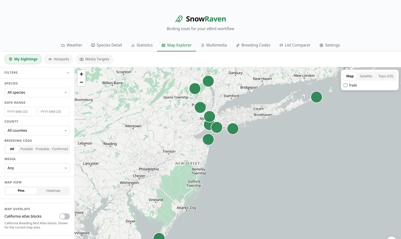
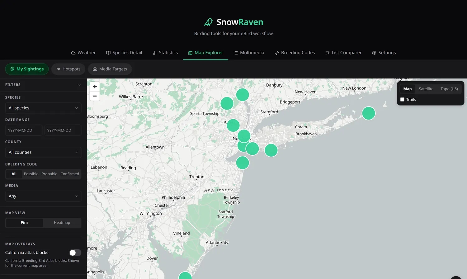
An interactive map of your sightings with an optional heatmap, nearby eBird hotspots colored by whether you've visited them, media targets, and a California Breeding Bird Atlas overlay. Optional county lines draw US county boundaries over the current view, kept crisp and accurate at every zoom because they come straight from the map's own tiles, and can shade each county by how many species (or checklists) you've recorded there, drawn from your own loaded backup, with a legend, a popup per county, and a keyboard-accessible list of the counties in view. A third Completeness metric shades each county by how complete your county list is — your countable species there measured against everything ever reported to eBird for that county, on a fixed 0–100% scale — with a per-county progress bar, your newest county species, and a short list of targets you haven't recorded there yet. That one metric needs a connection and your own eBird API key (the app says so right at the control); lookups stay bounded to the counties you've birded in view and are cached on your device for 30 days, so fetched counties keep shading offline. An optional colorblind-friendly Use Textures mode paints each county as a crosshatch whose density rises with your count, so you can rank counties without relying on color. Only one of the atlas or county shadings is active at a time, and while a shading ramp is on the basemap's land mutes to grey so the ramp stands out. A Point Size control lets you shrink or hide the sighting points so a shaded map reads through underneath. A Nearby Lifers section maps where species you haven't recorded yet were reported recently near a point you choose, each spot a labeled pin colored by how recently it was seen, with dates and checklist links a click away. Nearby Lifers and Media Targets each carry a locator dot at their exact coordinate and a Labels / Dots toggle, so you can collapse the marker chips to clean dots for an overview of where the birds are. Set a time range and radius, search a place name, use your location, or right-click the map (long-press on touch) to drop a pin and search from there. Switch between street, satellite, and topo basemaps, with a hiking-trails layer.

The Map Explorer tab showing sighting clusters around New York and New Jersey on a street basemap.

Multimedia

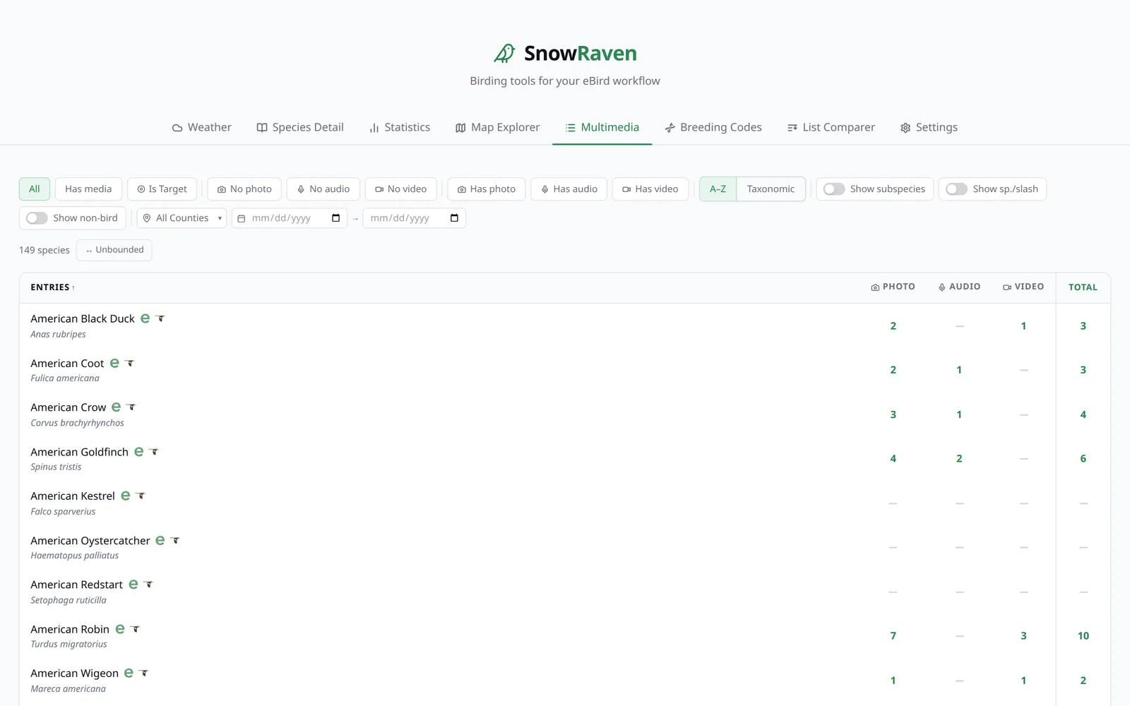
Your life list as a media checklist: photo, audio, and video coverage for every species, so you can see at a glance what you still need to capture. Filter by sex and age — pull up just your juveniles, or the males of a dimorphic species — with counts and links straight to the matching media in your Macaulay Library.

The Multimedia tab, a life-list table with photo, audio, video, and total media counts per species.

Breeding Codes

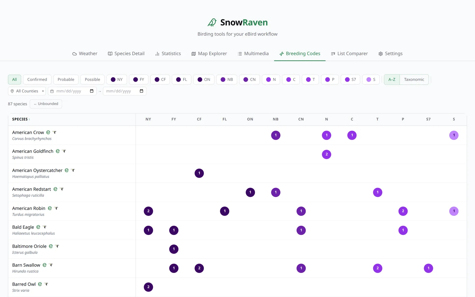
Every species you've recorded a breeding code for, laid out as a color-coded matrix across all eBird codes. Sort and filter by tier to see exactly where your breeding evidence stands. On a phone the columns tighten to dot-width so more fit at once, and you can pinch to zoom in on any part of the grid.

The Breeding Codes tab showing a species-by-code matrix with tier-colored count badges.

Named Birds

Give an individual bird a name in your eBird species comment with a [name:…] tag — like [name:Winky] — and SnowRaven gathers every sighting of that individual: its species, when you first and last saw it, how long you've followed it, how many times, and each checklist it appears on, with its location and a map of everywhere that bird has been seen. If you've saved your Macaulay Library export too, each individual also gathers its own photos, audio, and video — the assets whose own caption or media note carries that same name tag — as inline players from the Macaulay Library, each labeled with its date and checklist. Named birds also surface per-species on Species Detail.

Checklists

Your checklists as whole outings. Search every checklist comment and every species comment you've ever written, and browse a filterable list of all your checklists — combine has and doesn't-have filters for comments, media, breeding codes, completeness, protocol, county, and dates. Pasted weather and tide blocks stay hidden (and out of search) until you ask for them.

List Comparer

Compare two life lists to see shared and unique species, or compare two individual checklists side by side: counts with the higher total emphasized, breeding codes, photo, audio, and video indicators, effort details, checklist and species comments, and side-by-side weather and tide for each checklist.

Offline support

Out in the field with no signal, SnowRaven keeps working from the data already loaded on your device. The maps and every analytical tab open offline once they've loaded online once — your sightings, heatmap, atlas, labels, and taxonomically sorted names with their icons all draw, even on a first cold start of the day. A checklist's weather and tide you looked up earlier re-show, marked as the last loaded result.

On the desktop app you can opt in to downloading offline map regions: while you have a connection, save the counties you bird (or whole states), then pan and zoom them later with full street detail. A manager shows each region's size, a running total, flags ones that are out of date, and lets you remove them. It's off by default.

SnowRaven is honest about the edges. Live lookups — current weather and tide, place search, the Checklist Comparer, nearby-bird overlays, and app updates — still need a connection; offline you see the last loaded result where one exists, or a plain note that you're offline. Only the vector street basemap works offline; satellite, topo, and trails need a connection.

Runs where you do

One app, everywhere you bird

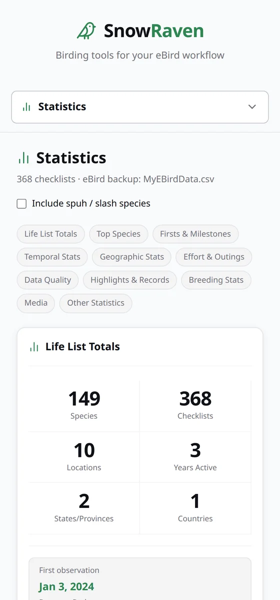
Install the native desktop app on a Mac or Windows PC, or self-host it on a Raspberry Pi (or any computer on your network) and open it from any browser. One universal Mac build runs on both Apple Silicon and Intel, and the whole interface is responsive, so it works on a phone or tablet too.

  • macOS — universal .dmg
  • Windows — .exe installer
  • Raspberry Pi / Linux — self-host
SnowRaven Statistics on a phone-sized screen, showing the responsive layout.

Get started

Up and running in a few minutes

Mac

Download the universal .dmg from the latest release, drag SnowRaven to Applications, then right-click the app and choose Open on first launch.

Download for Mac

Windows

Download the .exe installer and run it. SmartScreen may warn about an unknown publisher, so choose More info, then Run anyway. In-app updates are cryptographically verified.

Download for Windows

Raspberry Pi / Linux

Run one command on your Pi (or any Debian or Ubuntu machine). It handles packages, the build, the Python environment, and an optional auto-start service.

$ curl -fsSL https://raw.githubusercontent.com/dtgibson/snowraven/main/install.sh | bash

A personal project, shared freely

SnowRaven began as a tool for one birder's own data, and it's shared here, open source and free, in case other birders find it useful. It works alongside eBird and the Macaulay Library, building on the exports they let you download so you can look at your own observations from new angles. There's nothing to sign up for, and nothing to buy.